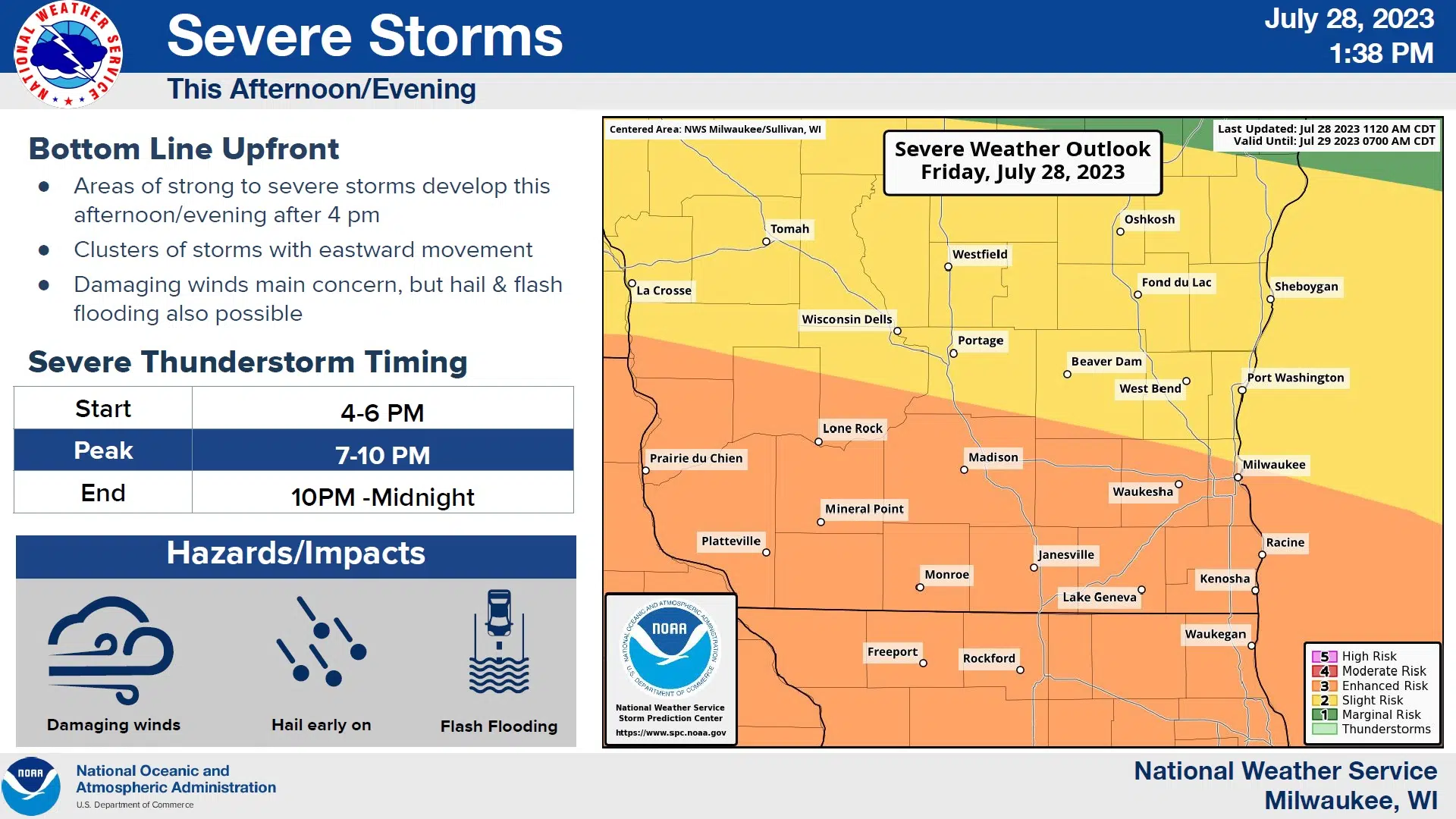
The potential for severe weather remains a possibility in Sheboygan County late this afternoon and evening, and the National Weather Service in Milwaukee has made minor adjustments to its predictions.
The most notable change has been that of delaying the estimates of the most likely impact by about an hour, now about 7 p.m. Forecasters did indicate that rather than one round, portions of southeastern Wisconsin may have a “more messy” several rounds to deal with, but mostly in the area south of I-94, but also lingering slightly longer here to around 10 p.m.
The most significant threat remains that of strong winds that could reach 60+ mph in the strongest storms, but that threat, along with that of damaging hail or any possible tornadic activity are all below 15 percent here. Rainfall which could somewhat alleviate severe drought conditions that dominate our area is expected to be between a half and one inch of rains, but consecutive lines of storms could put that total to between one and two inches.
Because weather is always a dynamic situation, forecasters advise the public to be prepared to secure any furniture or other items that may be blown by the wind, and also for the possibility of power outages in the strongest storms.
The outlook for the rest of the weekend is much more positive, with sunshine, lower humidity and daytime temperatures in the 70s expected both Saturday and Sunday.