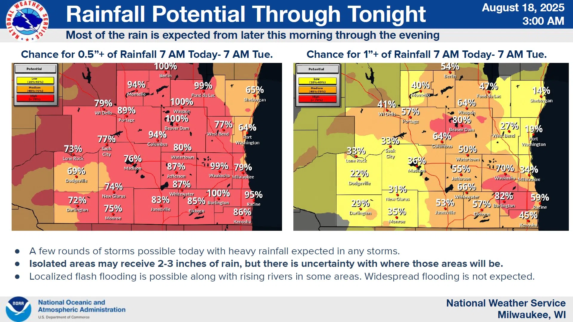
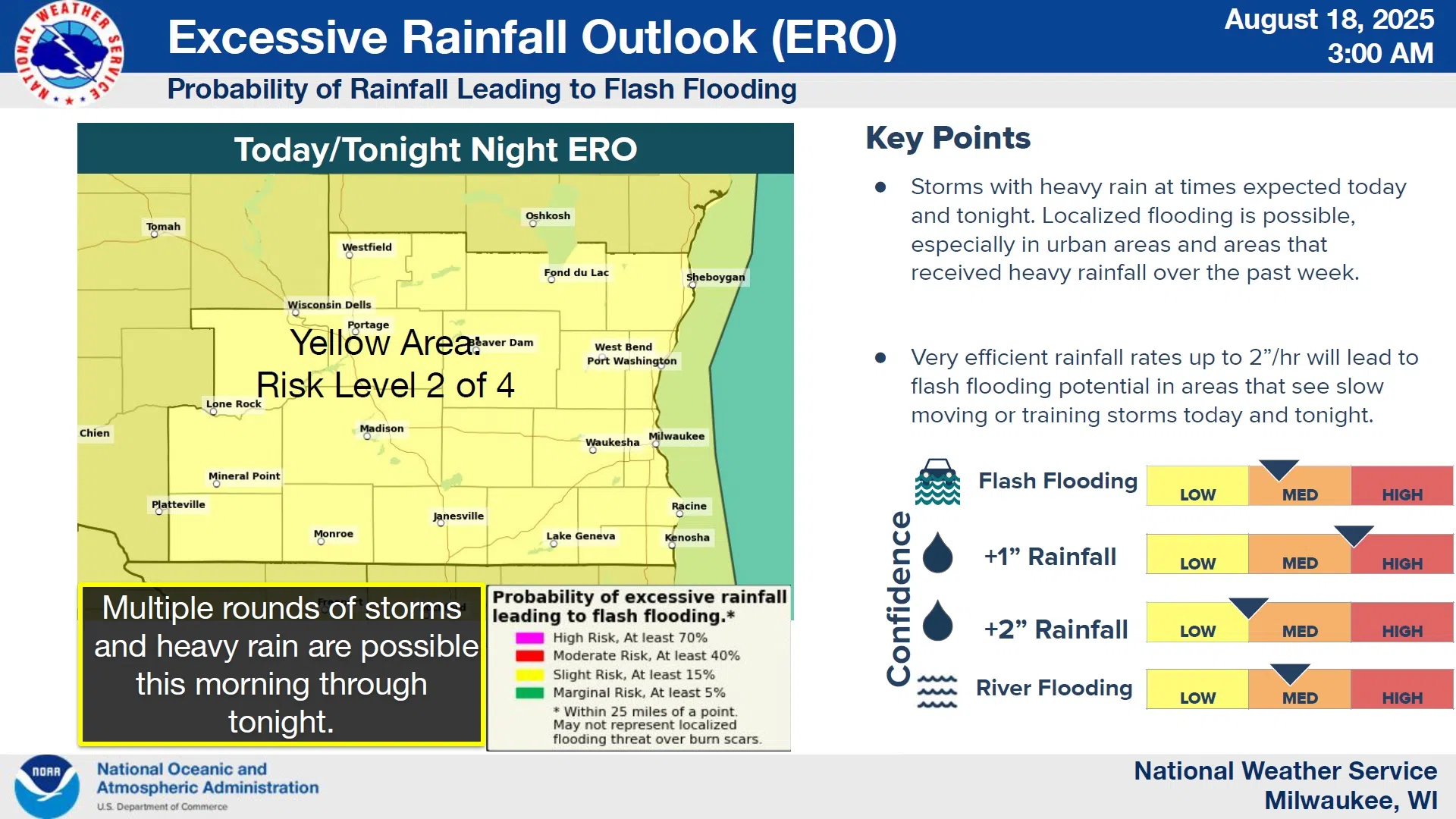
An abundance of moisture will be in place across Wisconsin today, setting the stage for still more heavy rainfall over much of the state, possibly including the Sheboygan area.
Scattered thunderstorms were already affecting central Wisconsin early this morning and were spreading toward the lakeshore, and will be most likely for a 12-hour period between 4 PM today and 4 AM on Tuesday. While rainfall here will probably be less than an inch, areas already stricken by flooding a week ago will be vulnerable to experience up to 3 inches in some spots in southern Wisconsin.
NWS Graphic
The risk of severe thunderstorms is a slight 1-out-of-5, but any that reach severe limits pose the greatest threat from damaging winds along with the rainfall.
Temperatures will be mild in the 70s today, and after a low in the upper 60s, a high near 80 is expected under partly sunny skies on Tuesday.


Comments