Although there’s plenty of uncertainty, the National Weather Service is advising that someone, somewhere in Wisconsin, may experience heavy rainfall tonight into Tuesday.
Right now the most likely times to get that rain appears to be Saturday night into Sunday morning, and then again Sunday night into Monday morning. But exactly where each round occurs depends a lot on where previous rain fell, and a good forecast might be as little as 12 hours in advance.
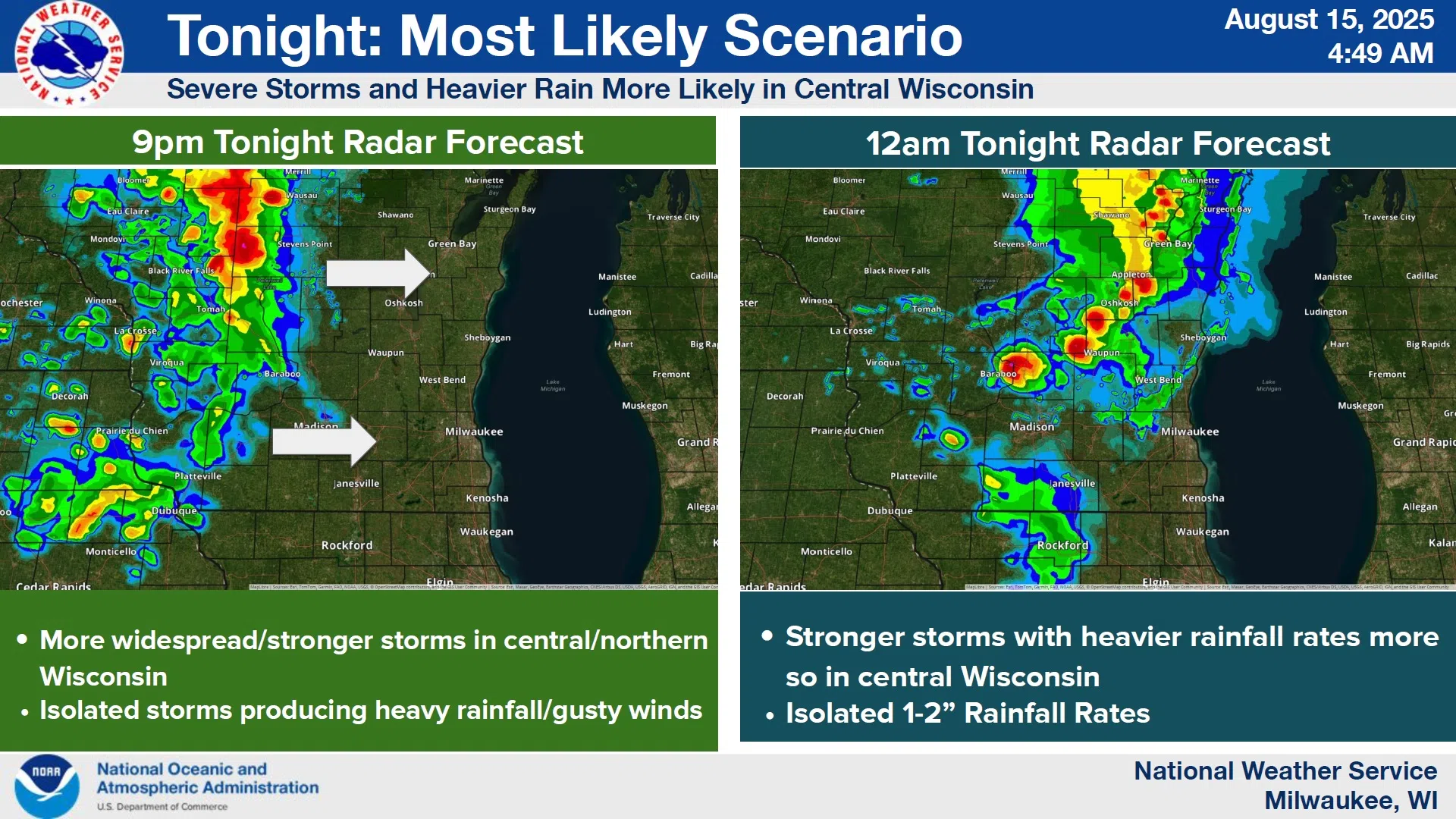
NWS Graphic
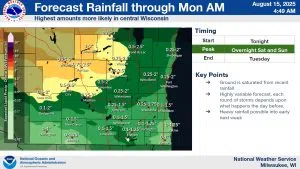
The best estimates for the Sheboygan area suggest anywhere from one-quarter, all the way up to 2 inches during the period, but the odds of getting over one inch are just a little better than even.
The first round of storms will dump most of its rain tonight between 9 and midnight in central Wisconsin, weakening somewhat by the time it reaches us around midnight. Later forecasts should be monitored as we get into the weekend.


Comments